 |
We had saved Death Valley for the last day of our trip, knowing it would be a lot of driving (it turned out to be less than going to the Grand Canyon). I've already described the first part of the day in my earlier post about Rhyolite, so we'll pick up from there.

From Rhyolite, we continued driving on NV Hwy 374, across the state line into California and into Death Valley. As the mercury rose, miles of flat lay before us.
 |
| Harmony Borax Works. |
A few miles further and we noticed some ruins a little way off the road. We ignored the climbing temperatures; we were here to explore, and so explore we did. Harmony Borax Works was in operation from 1883-1888. Borax was "the gold of Death Valley". I shuddered to imagine how they managed the heat (which by now was about 113 Fahrenheit) as they worked.
 |
| Once pulled by a 20-mule team to transport borax. |
Soon we reached Furnace Valley Visitor Center, where we refilled every water bottle in the car, using the handy-dandy refill fountains, browsed the visitor center, and bemoaned the lack of spoons. My mother collects them and they are becoming increasingly difficult to find - National Parks, take note!
 |
| Not the highest. |
Once we got back in the car, I resumed my habit of taking pictures of every view. Every few feet or so, I would insist we pull over so I could photograph the miles of nothing.
And then, there it was. The magical 120 Fahrenheit.
But no, still hotter it became.
No longer able to get any reception on our phones, we were relying on the car's dash for outside temperature readings.
And since you're no doubt dying to know how hot it got that day, here you are...
 |
| 122 degree Fahrenheit. |
Ladies and gentlemen, I give you 122 degrees!
It's kinda warm!
But back to Death Valley and the scenery.
Now here's the part that puzzled me. We were on Badwater Road when we saw the sign noting the turn-off to the Artist's Palette. I knew from reading up that this was the scenery we really wanted to see - a colorful blend of mineral-soaked rocks. But the few other cars on the road bypassed it completely. How often do you get to see this?
Artist's Drive took us on a looping tour through the beautifully-colored rock formations. Words can't do them justice, and the changing position of the sun must surely mean that they always look different. I'll simply share some photos.
 |
| Artist's Palette |

Once we rejoined the main road, we continued on to Badwater Basin, which holds the distinction of being the lowest spot in North America - 282 feet (855 meters) below sea level. For trivia fans, Mount Whitney, the highest spot in the contiguous 48, is just 84 miles away.
 |
| Spot the Sea Level Marker - yes, I've circled it to make it easier for you! |
We emerged from the air-conditioned car to walk along the platforms by the delicate salt flats, and this is where the heat really started to feel intense.
Have you ever been somewhere so hot that you feel as if you are standing in front of an open oven door?
Somewhere so hot, that your hands are actually cooler when you put them IN your pockets because that removes them from the blasting dry heat?
I have now.
Even with plenty of water, after a few minutes I could feel my throat tightening from the heat. The air was so dry that all moisture evaporated immediately.
I had finally met my match.
 |
| Badwater Basin |
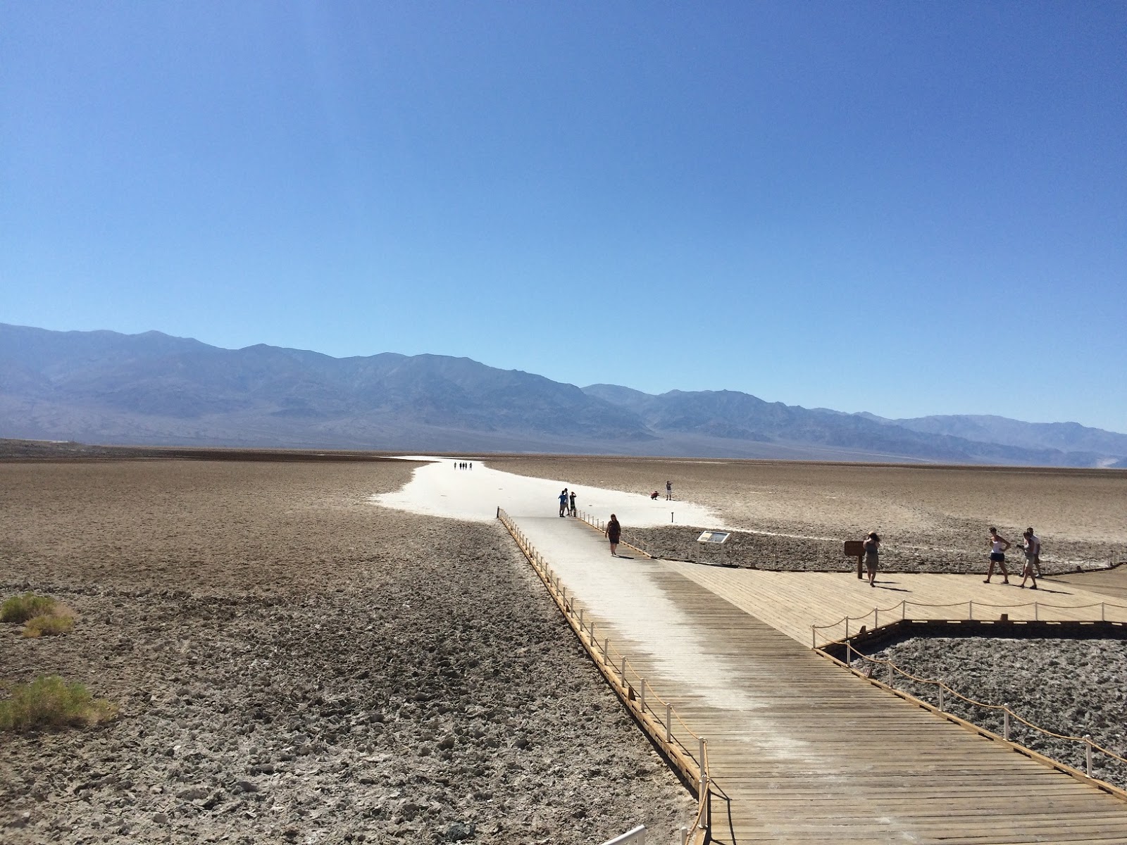 |
| Wooden platforms protect the delicate salt flats. |

If you were low on gas, this was your opportunity to fill up, for the princely sum of $5.50 a gallon. To be fair, this was miles from anywhere so the simple law of supply and demand was in evidence, although I suspect there may have been a cheaper, unadvertised rate for locals.
 |
| St. Therese Mission, Tecopa, CA. |
 |
| Dust sweeps through the valley. |
Death Valley was, without a doubt, my favorite part of the trip. It is a beautiful wilderness and experiencing it in such heat, it is almost unfathomable how people made their livelihoods out here. But they did, as the ruins of Rhyolite show. And they still do, as is evidenced in Shoshone and Tecopa. And back in the humidity of Kentucky the next day, I found myself uncomfortably sweaty and missing the dry heat of the desert.
 |
| Drops of water in the salt flats at Badwater |
 |
| A long-dried river bed near the Artist's Palette |
 |
| Death Valley: Land of Extremes |
 |
| More spectacular colors at Artist's Palette |
 |
| The obsessive photographer |
No comments:
Post a Comment